Included with Premium
Ordnance Survey maps
Plan with OS Explorer and OS Landranger scale maps showing paths, contours, access land and terrain.
FootPathMap Premium
Plan walks with detailed maps, draw and save routes, check distance and elevation, and add useful map layers and tools.
Already a member? Sign in
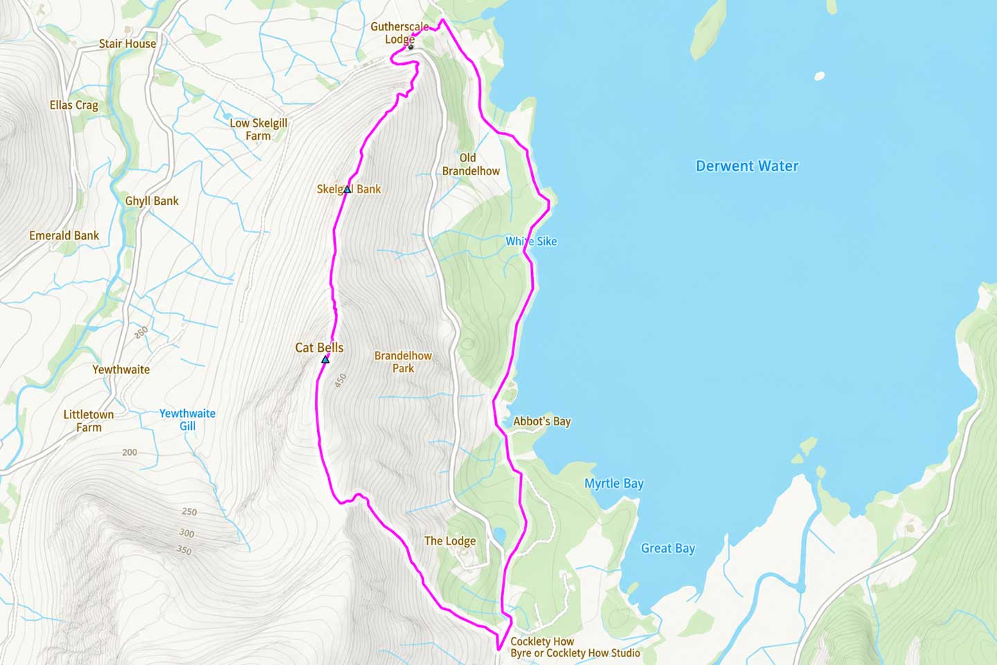
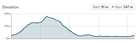
Route planning
Use detailed mapping to choose your route, then check the distance and elevation profile before you set out.
Plan with OS Explorer and OS Landranger scale maps showing paths, contours, access land and terrain.
Plan a route on the map, check its distance and save it to your account.
Check the elevation profile and total ascent before setting out.
7 days free, then £3/month. Renews monthly until cancelled. Cancel online at any time. Card required.
Included map layers
Choose the layers you need for the area you are exploring.
See mapped open-access land alongside footpaths when planning walks across moorland, mountains and commons.
Browse more than 20,000 named hills and check their height, drop and classification before choosing a route.
Compare modern mapping with old roads, buildings, quarries and landscape features.
See national and local cycle routes and how they connect through towns and countryside.
Find heritage sites and country parks when choosing a destination or a stop along your route.
Use satellite imagery to see where paths run through fields, woods and built-up areas.
Save, share and customise
Share a route, save a map image or customise your map.
Create a link to a saved route so anyone can view it. Premium members can import their own copy.
Download the current map view to print or keep on your phone as an offline reference.
Choose path colours, line widths, distance and elevation units, then add a scale bar or rotate the map.
Open a location in Google Maps for Street View, nearby businesses and driving directions.
Search by place, postcode, coordinates or Ordnance Survey grid reference. On compatible devices, Premium also adds orientation, a bearing back towards your location and a re-centre button.
Free vs Premium
Premium adds the route planning, maps, layers and tools below.
| Feature | Free | Premium£3/month |
|---|---|---|
| Routes | ||
Draw, measure and save routesPlan routes, measure distance and organise saved walks into folders. |
Not included— | IncludedIncluded |
Elevation profiles and total ascentInspect climbs while drawing a UK route or reopening a saved route. |
Not included— | IncludedIncluded |
GPX import and exportBring in an existing GPX route or export one for a compatible device or app. |
Not included— | IncludedIncluded |
Route sharingAnyone can view a shared route; Premium members can create links and import copies. |
View onlyView only | Save and shareSave + share |
| Maps | ||
Public rights of way and national trailsSee public rights of way and national trails on the map when planning a walk. |
IncludedIncluded | IncludedIncluded |
Ordnance Survey, satellite and historic mapsChoose the map that gives you the most useful view of the area. |
Not included— | IncludedIncluded |
| Layers | ||
Open-access land, hills and cycle networksAdd practical walking and cycling information to the map. |
Not included— | IncludedIncluded |
Heritage sites and country parksFind useful destinations and stopping points. |
Not included— | IncludedIncluded |
| Tools | ||
Place, postcode and grid-reference searchGo directly to the area you want to explore. |
Not included— | IncludedIncluded |
Favourite placesSave useful locations and download the current map view. |
Not included— | IncludedIncluded |
Map colours, widths, units and location toolsAdjust the map to suit you, with compass and orientation on supported devices. |
Not included— | IncludedIncluded |
Map and rights of way coverage varies by area. Device features depend on your browser and hardware.
Need a hand? Get in touch.
A card is required to start the trial. After 7 days, the subscription starts at £3 a month and renews monthly until cancelled.
Sign in, open My Account, choose My Subscription and select Cancel. A paid subscription will not renew and Premium access continues until the end of the current billing period.
Yes. Cancel from My Account before the trial ends and you will not be charged. Premium access ends when a trial is cancelled.
Yes. FootPathMap works in a web browser. Sign in with the same account on each device to use Premium and access your saved routes and places.
Yes. Premium includes OS Explorer and OS Landranger scale maps for Great Britain, alongside satellite and 1900s historic map choices.
Yes. Premium users can import GPX routes and export saved routes as GPX files for compatible watches, devices and apps.
FootPathMap Premium
£3/month
7 days free, then £3/month. Renews monthly until cancelled. Cancel online at any time. Card required.