PREMIUM ACCESS
Already Have A Subscription? Sign In Here
Base Map
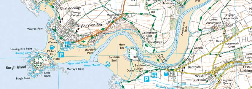
Ordnance Survey
View OS Explorer and OS Landranger scale maps for the whole of the UK. Find trails, boundaries, landscape features and places of interest.
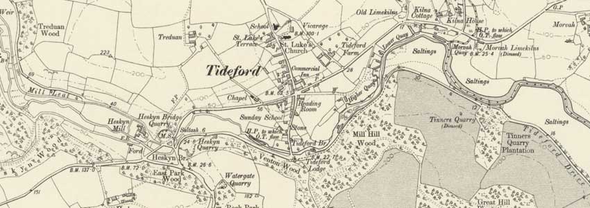
1900s Historic Map
Travel back in time! See the map as it was over 100 years ago, with buildings, roads, quarries and even some of the footpaths.
Layers
Right to Roam
You can access some land across England, Wales and the Isle of Man without having to use paths - this land is known as ‘open access land’. This includes mountains, moors, heaths and downs that are privately owned. It also includes common land registered with the local council and some land around the England Coast Path.
Cycle Network
The National Cycle Network is a 16,575 mile system of signed and numbered routes across the UK. Combined with this are the Department for Transport cycle planner routes, which cover the cycle paths across most urban areas, giving you the easiest way to explore the local area on bike or foot.
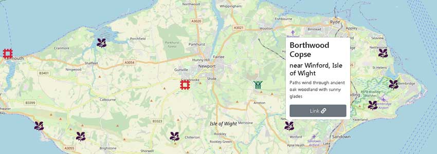
Points of Interest
Discover over 680 National Trust™, 350 English Heritage™, 300 Historic Scotland, 120 CADW and 500 country parks across the UK. Perfect as a starting point, interesting detour or cake and tea stop on any walk.
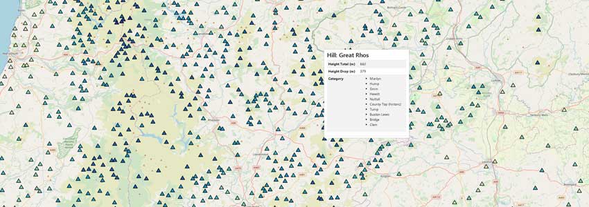
British and Irish Hills
Display the locations of over 20,000 named hills across the country, colour coded by height and with drop and category details available. Filter by specific types to challenge yourself to climb all your local ones, or to make sure your walk won't contain a nasty uphill surprise!
Tools
Open Google Maps
Google Maps doesn't have footpaths, but its Street View™, satellite imagery and locations are ideal when researching a walk. Link directly from your location to Google Maps, allowing you to take advantage of all its features.
Favourite Location, Routes, and Measurement
Save your own private points and routes directly on the map. With multiple customisations to choose from; save where you parked the car, plan the route you want to walk or measure how long it is.
Save Offline Image
Save the current view as an image to print out an offline copy, or to share with friends and family.

Customise Map
Adapt the map the way you want, choose your own colours and thicknesses to highlight the features which are important to you.
Compare Features
Use your phone or tablet's GPS functionality to display your location on the map.
A premium subscription adds:
- Orientation View which direction your device is facing.
- Bearing The direction from the current map location, back to your current location.
- Centre Me A convenient button to re-centre the map on your location.
* Requires compatible web browser/device
Show (where available) public right of way lines for Footpaths, Bridleways, Byways and Restricted Byways.
National Trails are long distance footpaths and bridleways in England and Wales.
The England Coast Path is a partially completed long-distance National Trail which will follow the coastline of England. When complete, it will be 2,795 miles (4,500 kilometres) in length.
Link directly from your current map view to Google Maps™, to make use of their useful extra features such as Street View™, business information and driving directions.
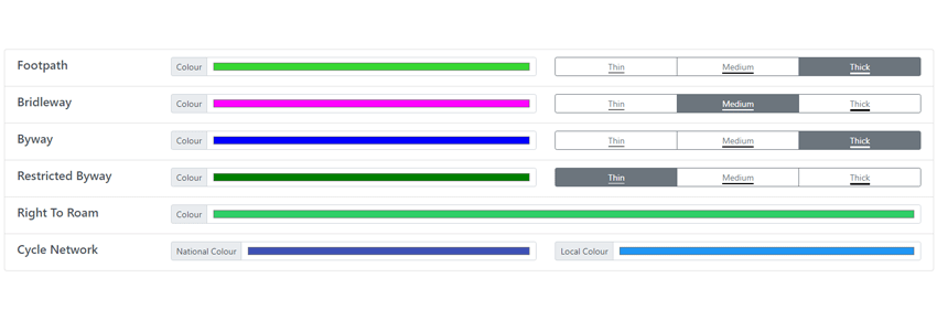
Customise the colour and thickness of all public right of way lines and areas on the map.
Adds the ability to enable a scale bar (in kilometres or miles) to help you estimate the distances on the map.
Adds the ability to enable map rotation, allowing you to orientate the map in whichever direction you choose.
Looking for a specific place? You can search the map for any part of an address, from town/village/road names to postcodes.
Know the coordinates? You can also search by Latitude/Longitude and Ordnance Survey National Grid.
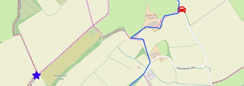
Save your favourite locations as special markers on your own private map. Use them to mark out points of interest on a walk, or to remember where you parked the car.
Draw and save your own routes on your own private map. Plan the route of a walk before you head out or draw a previous one to calculate how far you walked.
Measure the distance of a route you plan to walk, or one you have already done.
Export routes to GPX file, allowing import on smart watches and other fitness devices.
Save the map view as an image file, which can then be printed or viewed offline.
View over 6,250 square miles (16,000 km2) of right to roam land in England and Wales.
The National Cycle Network is the national cycling route network of the United Kingdom, which was established to encourage cycling and walking throughout Britain.
Show the locations of National Trust™, English Heritage™, Historic Scotland, CADW and country parks across the country.
Display the locations of over 20,000 named hills across the country.
View OS Explorer and OS Landranger scale maps for the whole of the UK.
See the map as it was over 100 years ago, with buildings, roads, quarries and even some of the footpaths.